UGR River Bowman Habitat Enhancement Project

GRMW ID: 1987

Fiscal Year: 2021

Project Status:

Complete

Description

UGR River Bowman Habitat Enhancement Project

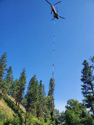
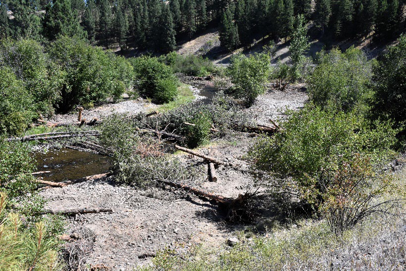
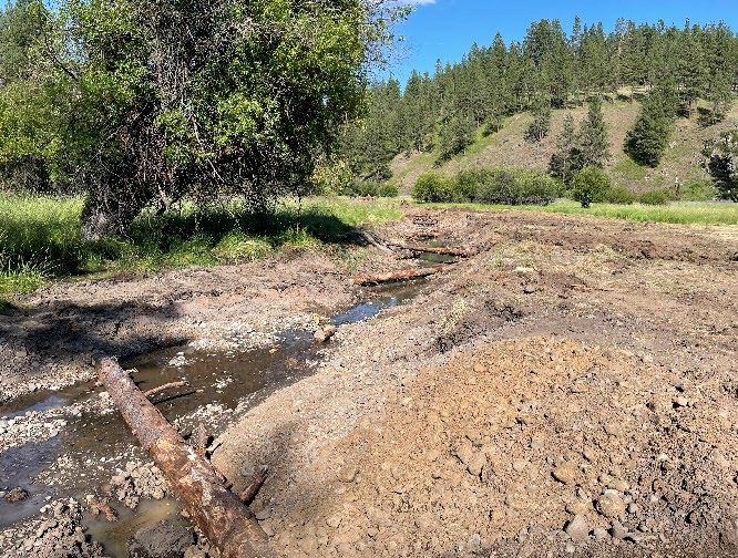
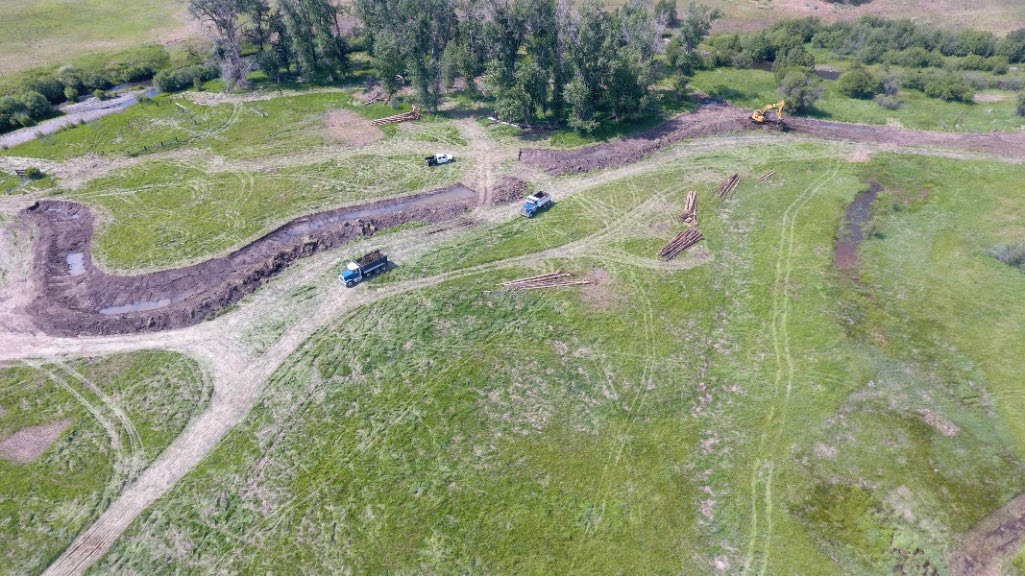
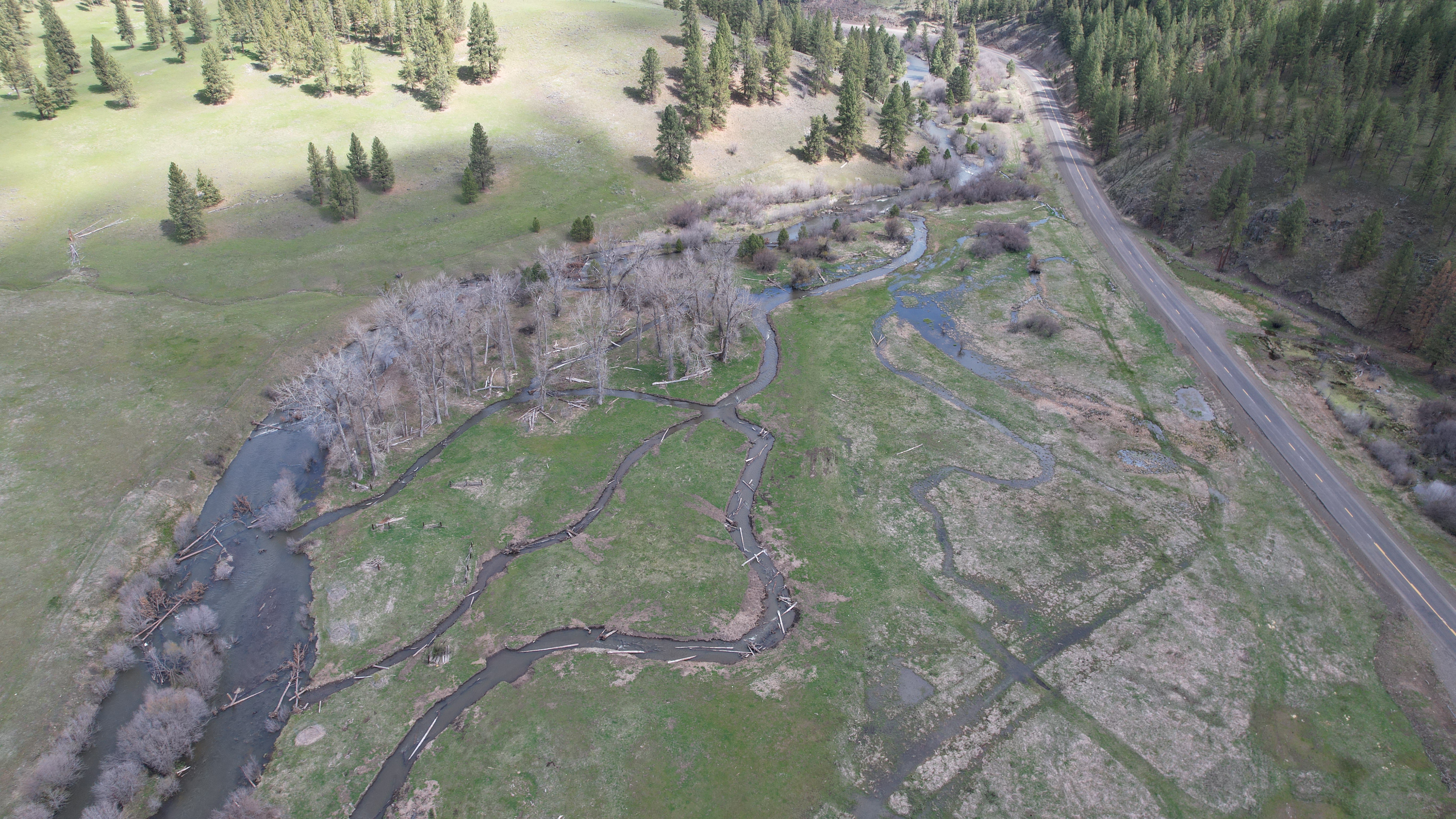
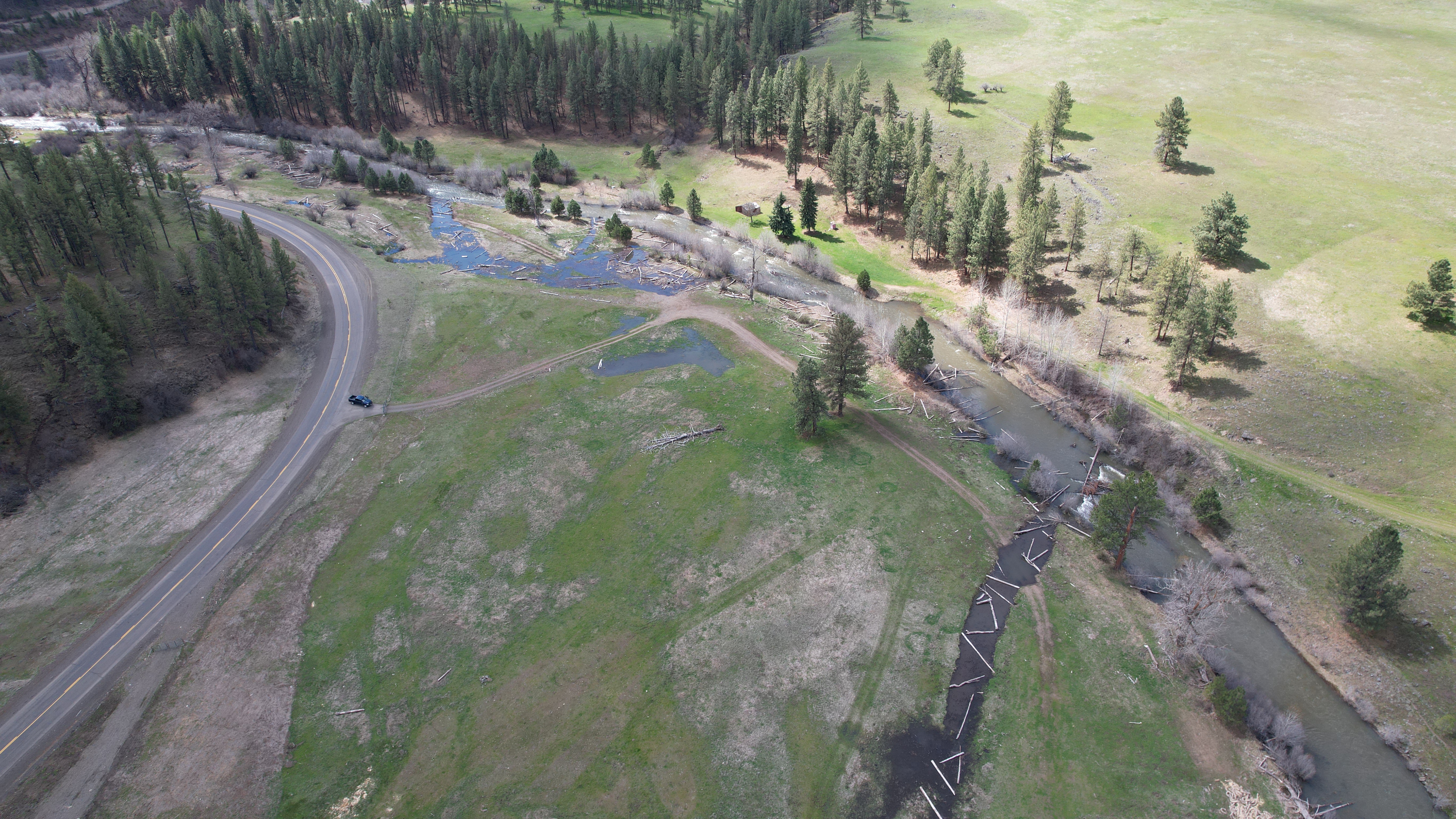
The Bowman Fish Habitat Restoration Project is located between RM 153.8 and 155.2 of the Upper Grande Ronde River, tributary to the Snake River, in Union County, Oregon. The project reach is in UGR Atlas Tier 1 habitat and this opportunity ranked 6th overall in the UGR basin. This section of the Grande Ronde River provides important spawning and rearing habitat for ESA listed spring Chinook salmon and summer steelhead. Chinook and steelhead spawning and rearing occurs in the project reach. It is also used by ESA listed bull trout, Oregon Sensitive Species redband trout, and other important native fish species. Throughout the project reach, the Grande Ronde River is over-widened and shallow. Pool habitat and wood recruitment is poor. High water temperatures impact adult Chinook salmon during migration and holding and juvenile rearing. Salmonid winter and summer rearing, adult immigration, adult holding, and spawning/incubation/emergence have been identified by the Upper Grande Ronde science and technical advisory committee as critical life stage uses in need of immediate action for population abundance, productivity, and sustainability. Riparian condition, water temperature, side channel and wetland conditions, and floodplain condition are identified as priority limiting factors that are critical to address. Restoration actions for this project target critical salmonid life stages and limiting factors, and include: pool development, floodplain reconnection, side channel and off-channel habitat restoration, riparian fencing, LWD placement, and channel reconstruction. This project will provide immediate benefits to ESA listed salmon and steelhead by improving and expanding migration, spawning, incubation and emergence, and summer and overwinter rearing habitats. This project will increase abundance and productivity of salmon, steelhead, and multiple native fish species.

Project Site Locations

Development Sites

Site name Latitude/Longitude Download
General Location 45.23748499999936/-118.39547800000061 Download KML

Contacts & Roles

Name Role Organization
Nick Smith Technical Contact Oregon Department of Fish & Wildlife
Winston Morton Contract Manager Oregon Department of Fish & Wildlife
Jeff Yanke Supervisor Oregon Department of Fish & Wildlife
Mary Estes Administrative Contact Grande Ronde Model Watershed

Organizations

Organization Role
Grande Ronde Model Watershed Cooperator
Oregon Department of Fish & Wildlife Sponsor
Bonneville Power Administration Funding Entity
Oregon Watershed Enhancement Board Funding Entity

Grants & Contracts

Organization Contract # Funding Amount
Oregon Watershed Enhancement Board 220-8205 $462075.83
Bonneville Power Administration 79905 REL 14 $681960.00

Documents

Document Type View Download
Project Proposal View Document Download Document
Project Summary View Document Download Document
Completion Report View Document Download Document
Acceptance Letter View Document Download Document
Line Item Budget N/A Download Document

Metrics

Metric ID Units Work Elements Metric
1387 1.53 29. Increase Aquatic and/or Floodplain Complexity # of miles of stream with improved complexity
1401 3.50 40. Install Fence # of miles of fence installed in a riparian area
1406 1.53 47. Plant Vegetation, 53. Remove Vegetation, 197. Maintain/Remove Vegetation, 198. Maintain Vegetation, 199. Remove Vegetation # of riparian miles treated
1482 0.05 33. Decommission Road/Relocate Road # of miles of road or trail created/relocated in the riparian zone
1517 0.38 47. Plant Vegetation, 48. Practice No-till and Conservation Tillage Systems, 53. Remove Vegetation, 180. Enhance Floodplain/Remove, Modify, Breach Dike, 197. Maintain/Remove Vegetation, 198. Maintain Vegetation, 199. Remove Vegetation, 30. Realign, Connect, and/or Create Channel, 31. Conduct Controlled Burn, 52. Remove Mine Tailings, 55. Erosion and Sedimentation Control # of acres of riparian non-wetland habitat treated
1518 10.00 47. Plant Vegetation, 53. Remove Vegetation, 197. Maintain/Remove Vegetation, 198. Maintain Vegetation, 199. Remove Vegetation, 30. Realign, Connect, and/or Create Channel, 31. Conduct Controlled Burn, 48. Practice No-till and Conservation Tillage Systems, 52. Remove Mine Tailings, 55. Erosion and Sedimentation Control, 180. Enhance Floodplain/Remove, Modify, Breach Dike, 181. Create, Restore, and/or Enhance Wetland # of acres of riparian wetland habitat treated
1549 1.53 40. Install Fence # of miles of left streambank fenced in a freshwater area
1551 1.53 40. Install Fence # of miles of right streambank fenced in a freshwater area
1595 88.00 29. Increase Aquatic and/or Floodplain Complexity # of logjam structures installed for both stabilization and complexity
1608 0.01 33. Decommission Road/Relocate Road # of miles of road or trail recontoured in the riparian zone
1672 0.38 180. Enhance Floodplain/Remove, Modify, Breach Dike # of acres of habitat treated by full dike removal in the Riparian zone
1681 0.09 180. Enhance Floodplain/Remove, Modify, Breach Dike # of miles of dike removed or modified by Full removal in the Riparian zone
1691 6.55 181. Create, Restore, and/or Enhance Wetland # of acres of riparian habitat restored/re-established
1743 350.00 40. Install Fence Average buffer width
1748 18.00 29. Increase Aquatic and/or Floodplain Complexity # of pools created for only complexity
1753 1.53 30. Realign, Connect, and/or Create Channel # of miles of main channel treated in the freshwater non-tidal zone
1754 0.65 30. Realign, Connect, and/or Create Channel # of miles of side channel created in the freshwater non-tidal zone
1760 4.50 40. Install Fence # of acres of riparian non-wetland habitat protected by fencing
1761 35.50 40. Install Fence # of acres of riparian wetland habitat protected by fencing
1626 5.00 40. Install Fence # of other exclusion structures
1523 50.00 33. Decommission Road/Relocate Road Average width of treatment