Middle Fly Creek Restoration/UGR HW Handcrew (Year 1 & 2)

GRMW ID: 1978

Fiscal Year: 2021

Project Status:

Complete

Description

Middle Fly Creek Restoration/UGR HW Handcrew (Year 1 & 2)

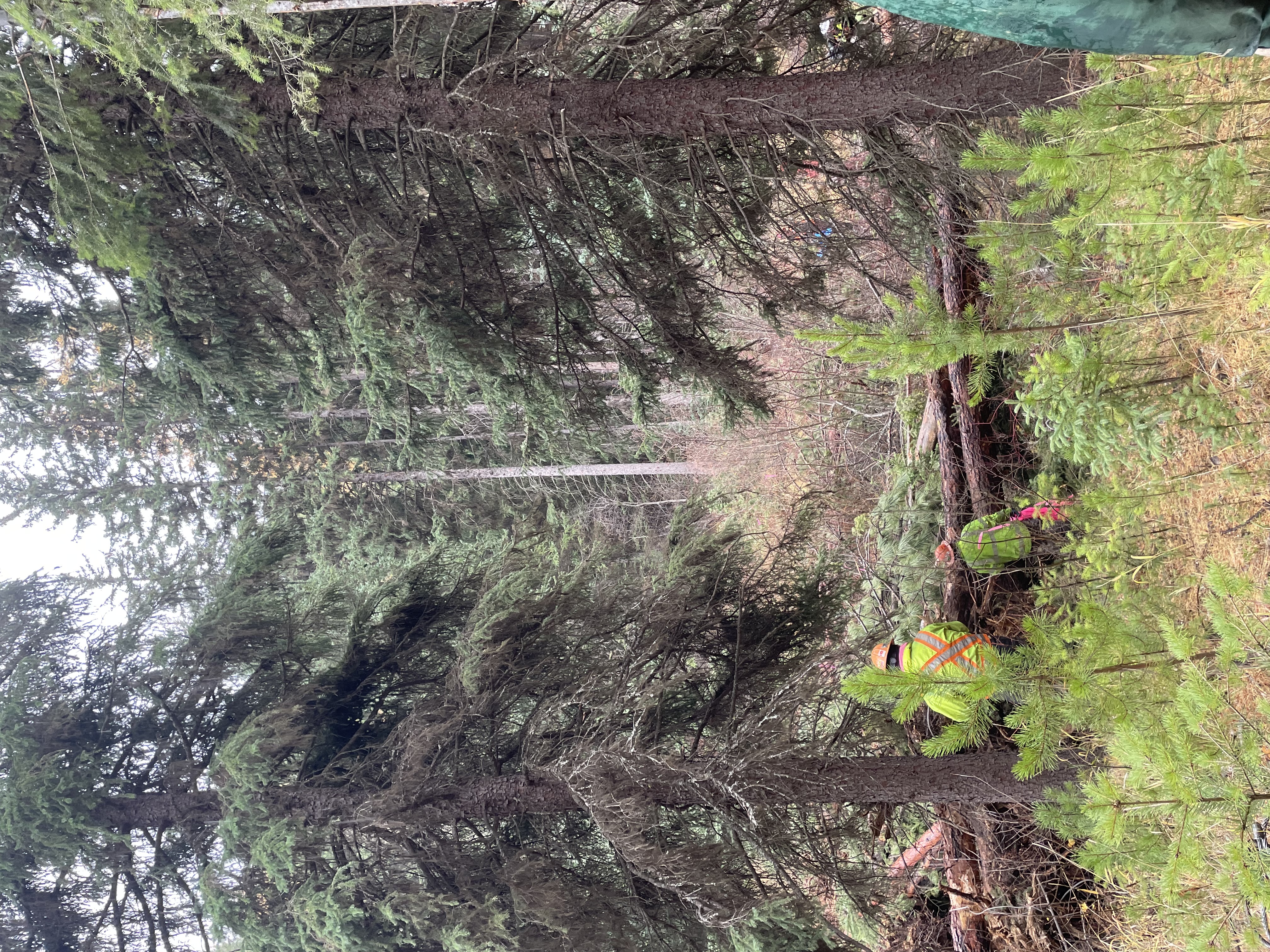
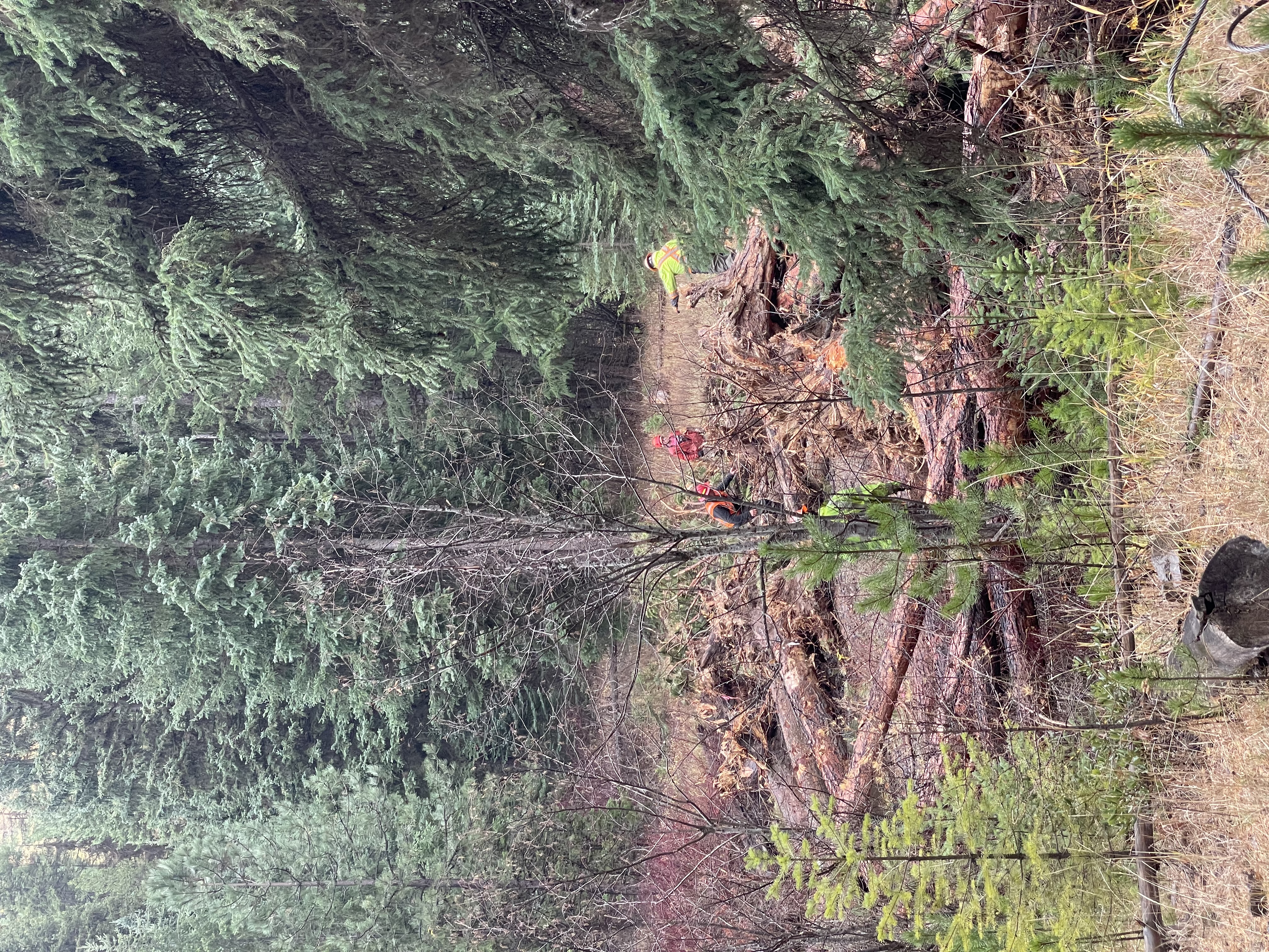
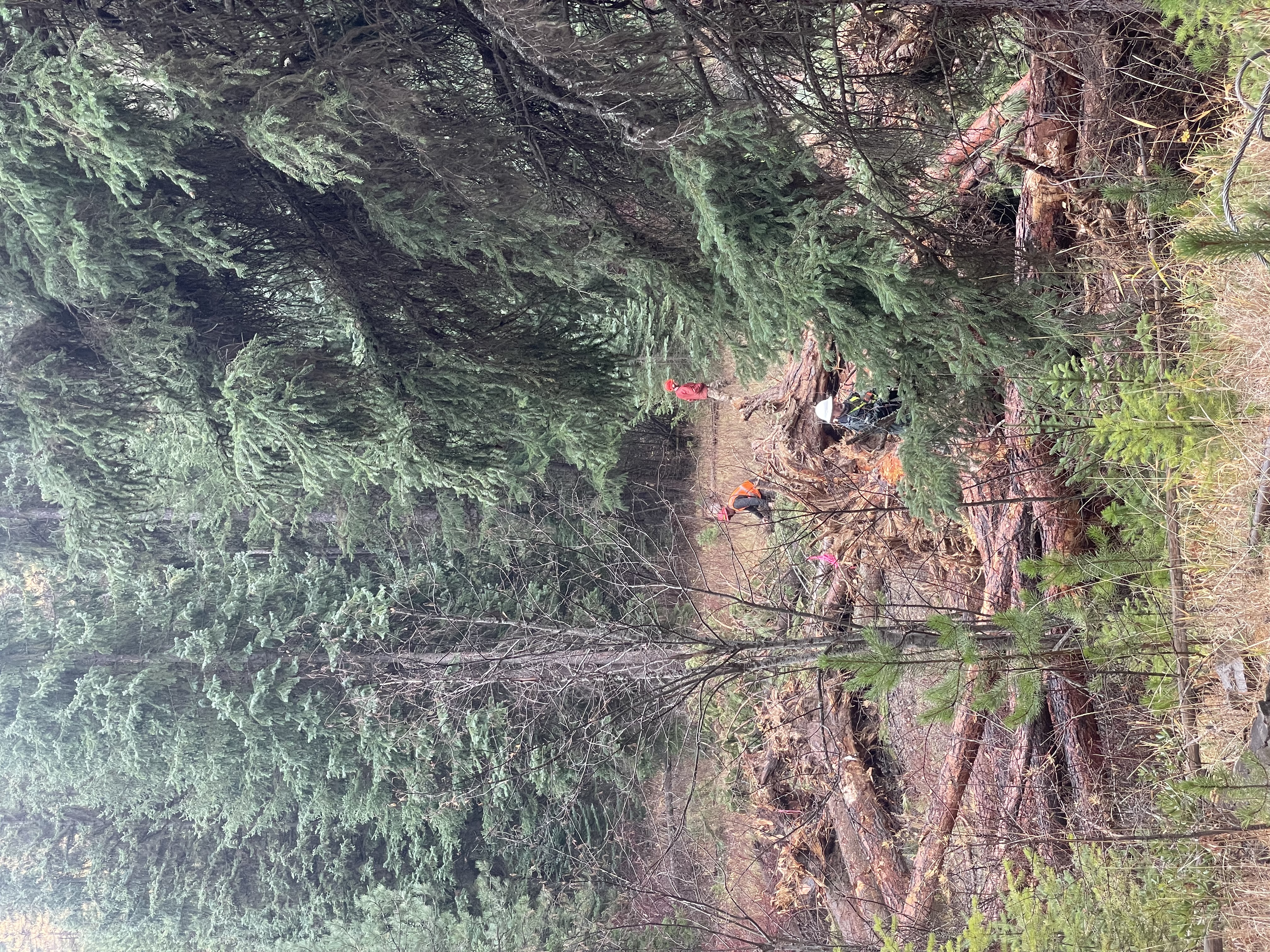
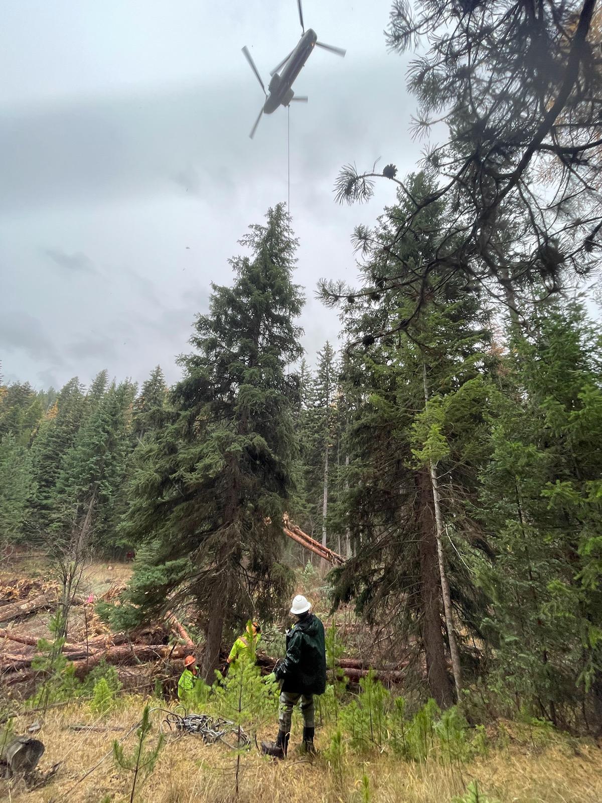
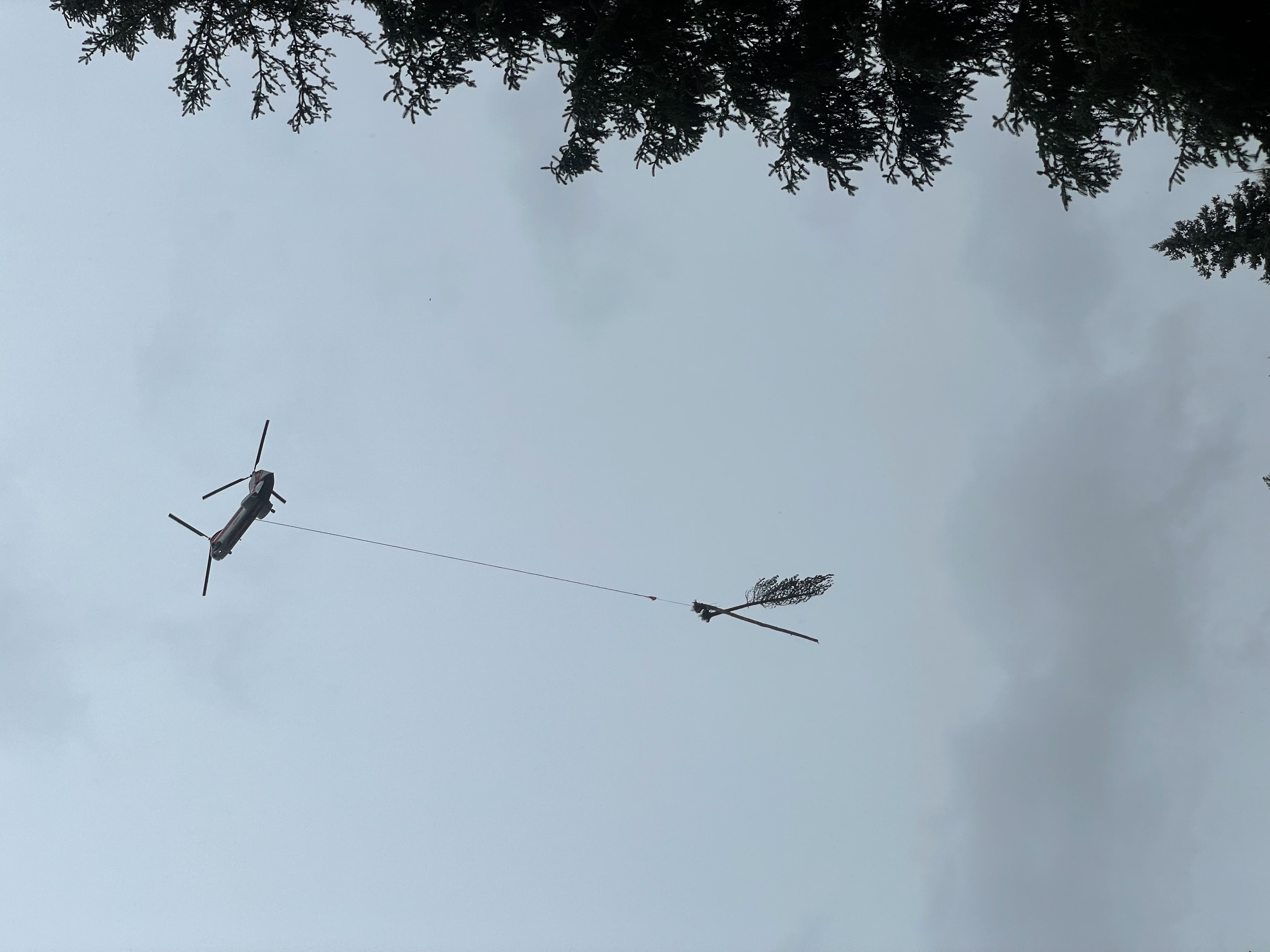
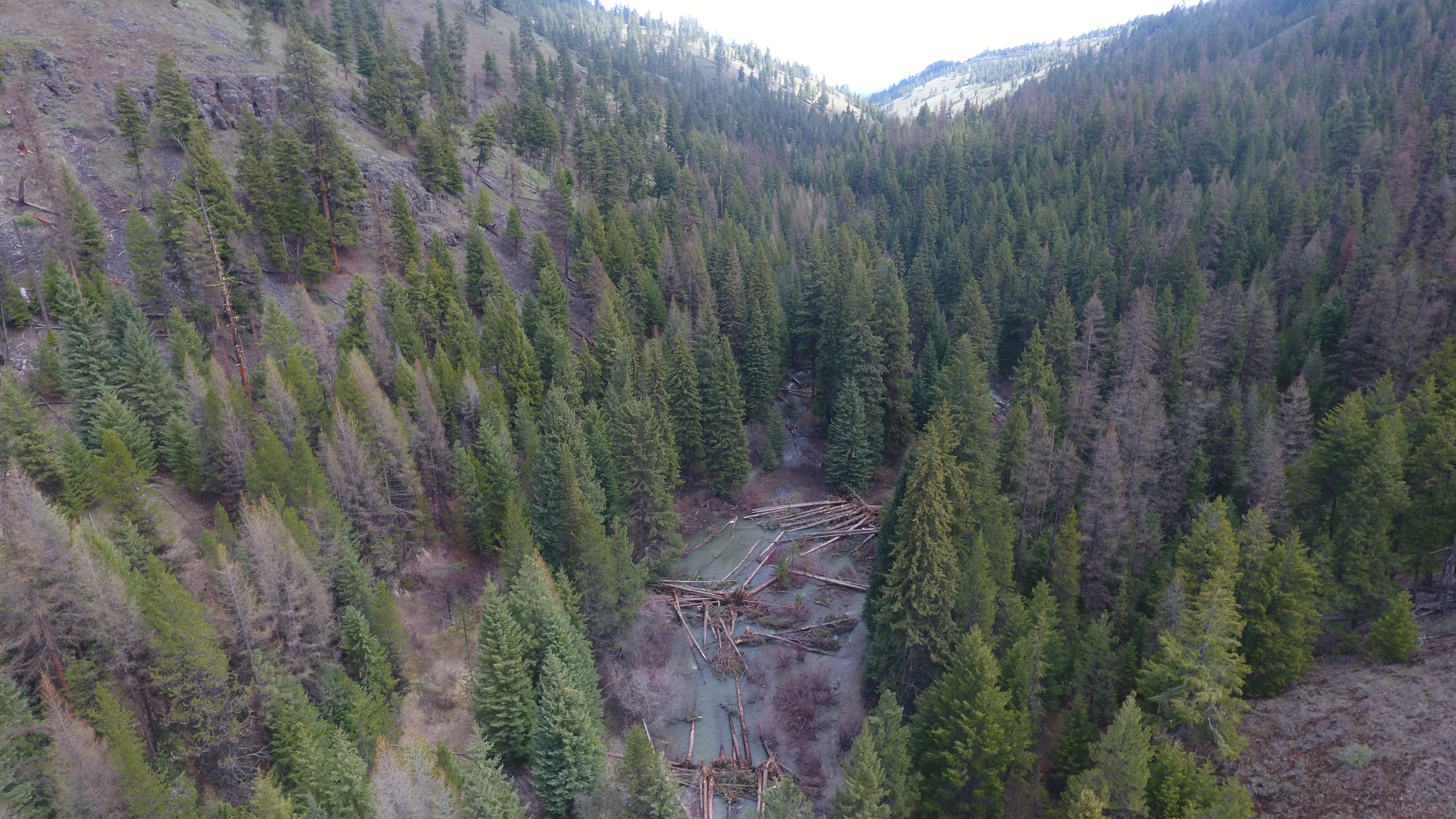
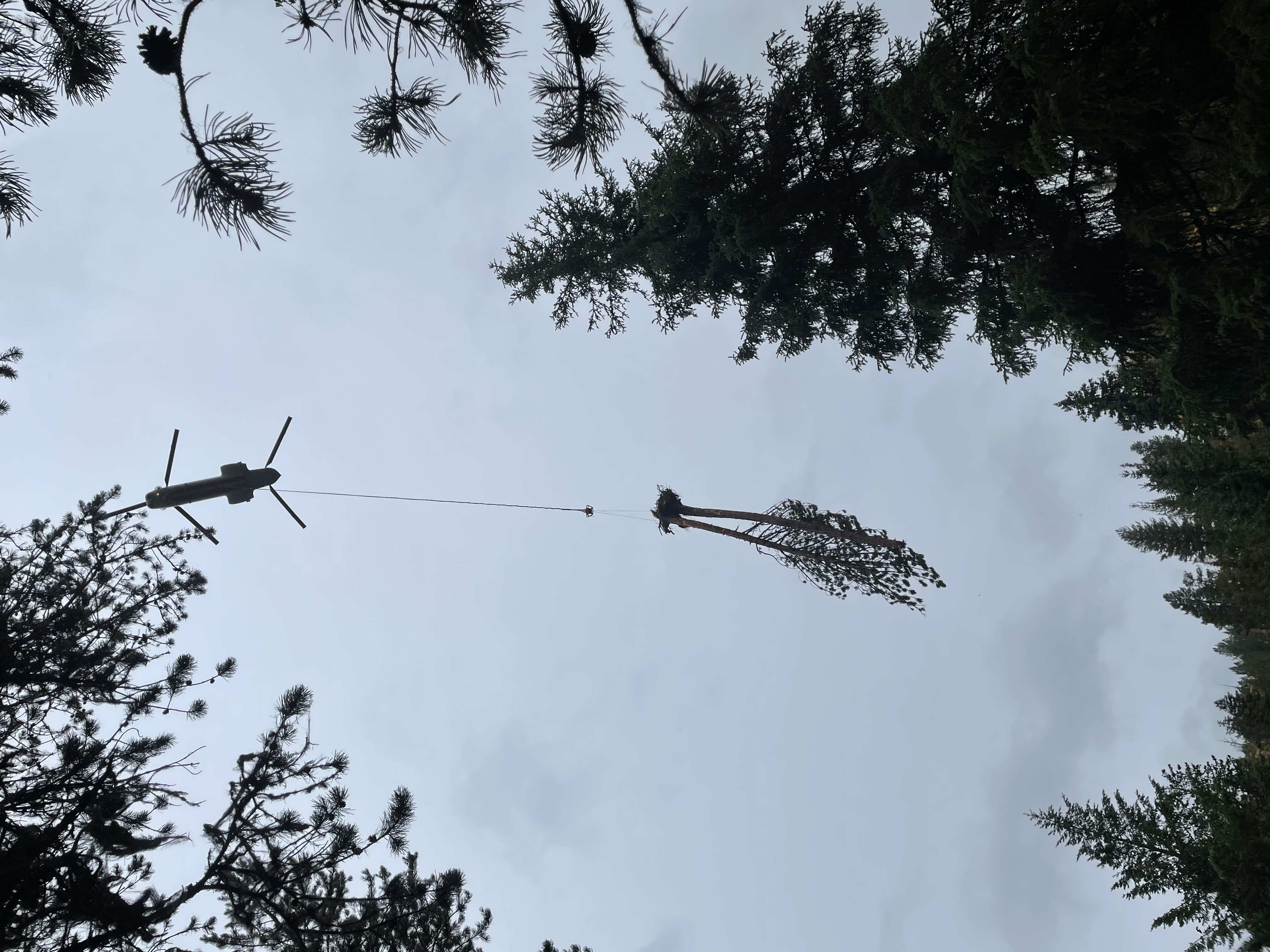
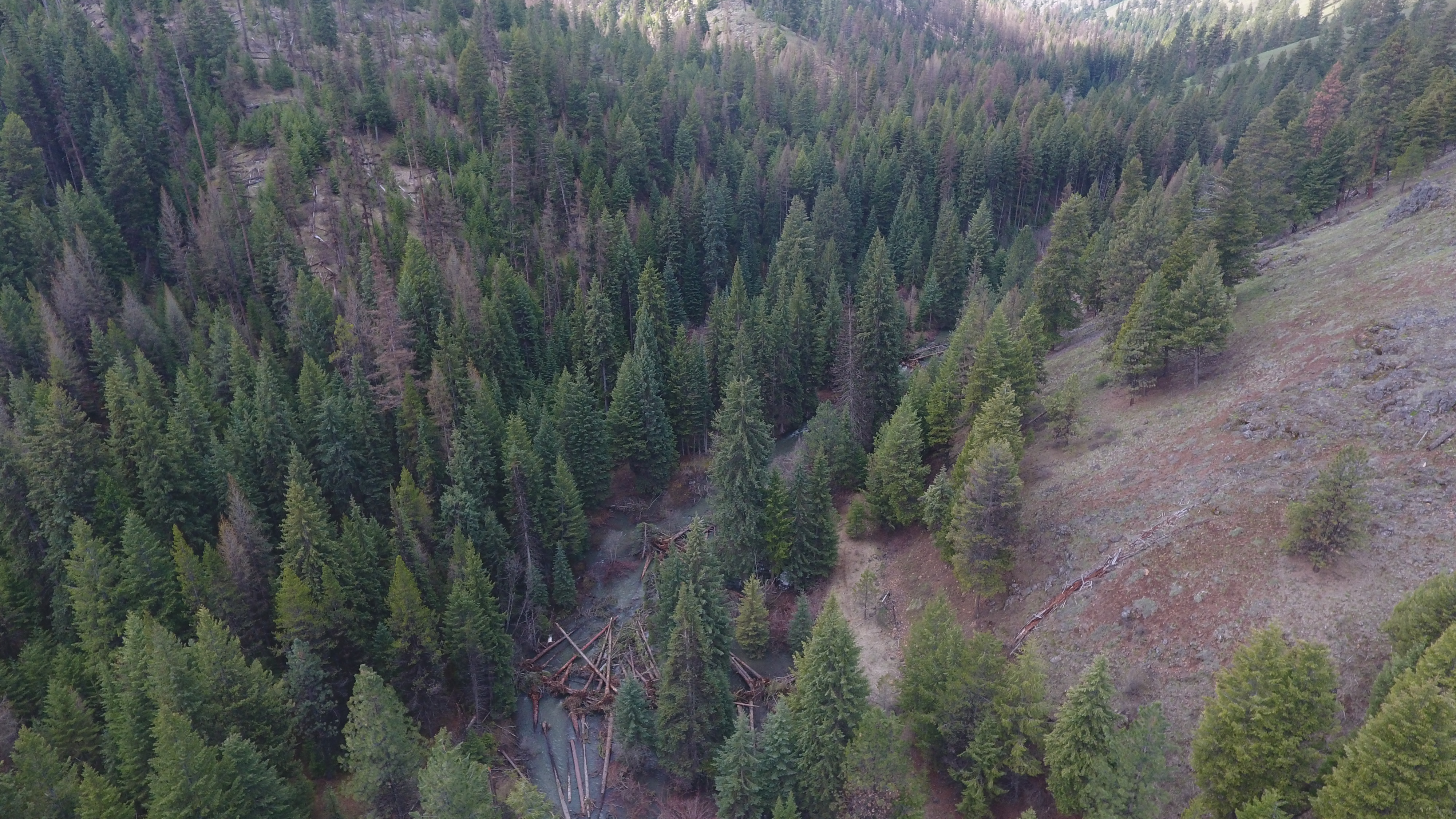
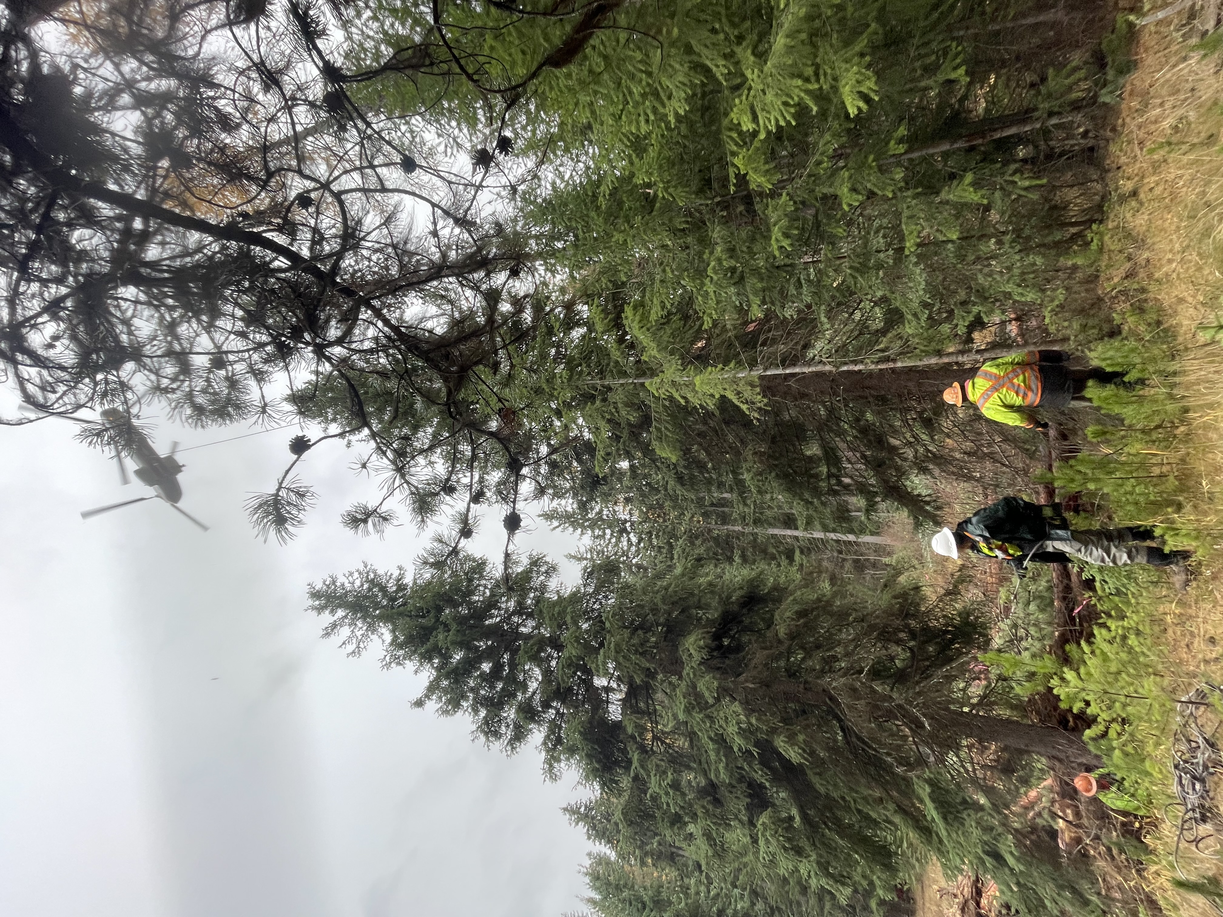
The Middle Fly portion of this project involves implementing restoration in Middle Fly Creek to improve habitat for listed spring/summer Chinook salmon and summer steelhead. The project is located in the Lower Fly Creek Subwatershed (170601040108(T 5S, R 35.5E, S 3, 4, 8, 9)). Currently, the stream channel is simplified with low levels of large wood, course substrate, and lack of quality pool habitat. Floodplain inundation and function is limited. The project would construct debris jams and habitat structures at 56 sites within the middle 3.0 miles of Fly Creek (RM 4.0 – RM 7.0). Approximately, 2400 trees and tops will be flown in and placed by helicopter. There will be 100 trees directionally felled by hand and 85% of the racking material will be incorporated into the structure and stream through hand placement. Project partners are United States Forest Service, Grande Ronde Model Watershed and Bonneville Power Administration.The hand crew portion of the project would involve placing wood into approximately 2.5 miles of channel within the Upper Grande Ronde River, 4 miles within Limber Jim Creek, and 3 miles within Chicken and West Chicken Creeks (9.5 miles of stream channel). The project will involve placing 2000 small trees into main and side channel areas, primarily to create or improve upon full spanning debris jams. Channel substrate will also be placed into the jams, where heritage resources permit. A mini excavator will be used in one mile of channel to construct jams, due to the distance from the stream to the trees. Within the main stream channels, existing full spanning debris jams will be targeted to increase backwater pool area, so that floodplain connectivity, side channel activation, fish cover and habitat complexity are improved. Within the side channels, new full spanning debris jams will be constructed with wood and channel substrate (where applicable). All of these streams have had previous restoration work completed on them. Partners include: USFS, GRMW, and BPA.

Project Site Locations

Development Sites

Site name Latitude/Longitude Download
Plant native seed. 45.06838299999955/-118.31336100000046 Download KML
Upper Grande Ronde River Wood Placement 45.069754999999546/-118.31437700000045 Download KML
Limber Jim Wood Placement 45.10019499999951/-118.3306620000005 Download KML
Chicken/West Chicken Wood Placement 45.056257999999346/-118.39590600000062 Download KML
Middle Fly Large Wood Placement 45.17269799999929/-118.41571000000066 Download KML

Contacts & Roles

Name Role Organization
Cecil Rich Supervisor United States Forest Service
Sarah Brandy Technical Contact United States Forest Service
Joe Platz Contract Manager La Grande Ranger District

Organizations

Organization Role
Grande Ronde Model Watershed Cooperator
Bonneville Power Administration Funding Entity
United States Forest Service Sponsor

Grants & Contracts

Organization Contract # Funding Amount
Bonneville Power Administration 79905 REL 10 $820915.00
Bonneville Power Administration 87212 $306880.00

Documents

Document Type View Download
Completion Report View Document Download Document
Acceptance Letter View Document Download Document
Project Proposal View Document Download Document

Metrics

Metric ID Units Work Elements Metric
1387 3.00 29. Increase Aquatic and/or Floodplain Complexity # of miles of stream with improved complexity
1387 4.00 29. Increase Aquatic and/or Floodplain Complexity # of miles of stream with improved complexity
1387 2.50 29. Increase Aquatic and/or Floodplain Complexity # of miles of stream with improved complexity
1387 3.00 29. Increase Aquatic and/or Floodplain Complexity # of miles of stream with improved complexity
1406 9.50 47. Plant Vegetation, 53. Remove Vegetation, 197. Maintain/Remove Vegetation, 198. Maintain Vegetation, 199. Remove Vegetation # of riparian miles treated
1515 45.00 47. Plant Vegetation, 48. Practice No-till and Conservation Tillage Systems, 53. Remove Vegetation, 197. Maintain/Remove Vegetation, 198. Maintain Vegetation, 199. Remove Vegetation, 31. Conduct Controlled Burn, 52. Remove Mine Tailings, 55. Erosion and Sedimentation Control # of acres of upland non-wetland habitat treated
1582 125.00 29. Increase Aquatic and/or Floodplain Complexity # of unanchored individual log structures (not logjams) installed for only complexity
1582 100.00 29. Increase Aquatic and/or Floodplain Complexity # of unanchored individual log structures (not logjams) installed for only complexity
1582 56.00 29. Increase Aquatic and/or Floodplain Complexity # of unanchored individual log structures (not logjams) installed for only complexity
1748 125.00 29. Increase Aquatic and/or Floodplain Complexity # of pools created for only complexity
1748 100.00 29. Increase Aquatic and/or Floodplain Complexity # of pools created for only complexity
1748 56.00 29. Increase Aquatic and/or Floodplain Complexity # of pools created for only complexity